The most widespread source of oceanic current data in the Solomon Sea comes from direct Shipboard Acoustic Doppler Current Profilers (SADCP) measurements. Most research vessels are equipped with SADCPs so that oceanic currents are recorded during either transits or cruises of various purposes. These data are assembled here to provide a comprehensive description of the oceanic circulation inside the Solomon Sea in the upper 300m. The range of transport variations as well as the current structures and vertical extent are estimated, in the straits.
- Reference: Cravatte et al. 2011
- ABSTRACT: The Solomon Sea, in the western tropical Pacific, is part of a major oceanic pathway for waters connecting the tropics to the equator via low latitude western boundary currents. Shipboard acoustic Doppler current profilers data from 94 various cruises and transits are used to describe the Solomon Sea mean circulation and its seasonal variability above 300m depth, providing an unprecedently detailed picture from observations. The circulation in the near-surface (20-100m) and thermocline (100-300m) layers were analyzed separately but found to have many similar features.
They are compared with circulations inferred from hydrological and satellite data.
The New Guinea Coastal Undercurrent enters the Solomon Sea east of Louisiade Archipelago (15 Sv inflow above 300m), splits and rejoins around the Woodlark Chain, then divides against the coast of New Britain forming two branches flowing westward and eastward. The westward branch has been previously observed flowing through Vitiaz Strait; in the present SADCP data this transport is found to be 7-8 Sv in the upper 300m. The eastward branch has been suspected and occurs in some models; it exits the Solomon Sea through St. George’s Channel (1-2 Sv) and Solomon Strait (4-5 Sv) in the thermocline. At the surface, waters enter the Solomon Strait from the north.
The seasonal variability can be documented in locations of sufficient data coverage. It is shown that this western boundary system strengthens in June to August, during the southeasterly monsoon. A summary of transport variability in the straits of the Solomon Sea from individual cruises is also provided. Transports in the straits display some stable features, but also high non-seasonal variability. - SADCP data site
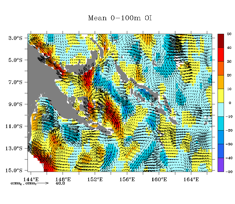
The figure below shows a time-average velocity estimated from SADCP data. The meridional velocity is given by the color shading, in cm/s.